SUMMARY OF THE STRETCH
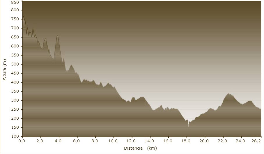
Distance covered: 44 km
Maximum height: 883m
Accumulated height: 968m
DATASHEET
GENERAL DESCRIPTION
Set out from the the main square or Plaça Major in Vic and take the bike route (bici carril) that will take you to a path leading into the village of Calldetenes. At this point follow the Ruta dels Molins, (the watermill route), which is a beautiful pathway that leads to the village of Saint Julià de Vilatorta (Saint Julian), following farmroads and paths to Folgueroles i Tavèrnoles. At this point follow the BV-5213 road with care (this road doesn’t have too much traffic), and it takes you to a hotel belonging to the Paradores Nacionales, called Parador Nacional de Sau. Turning off left, just before the Parador, one can visit the Monastery of Sant Pere de Casserres which is well-worth it. The route now takes you round the resorvoir on a narrow surfaced road just below the parador, which later becomes a wider road finally crossing over the resorvoir at the Sau dam, and then winds up to a surfaced forest track. This steep forest track carries on up to Rupit and is a fairly demanding ride all the way.


