SUMMARY OF STRETCH
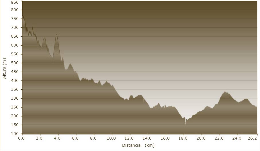
Distance covered: 42 km
Maximum height: 1.084m
Accumulated height: 1150m
DATASHEET
GENERAL DESCRIPTION
Leave Rupit via a very steep narrow stoney pathway to your right, sign-posted as going to Tavertet. The path takes you up to a surfaced farm track at the top that follows the cliffs of L’Avenc as far as Tavertet. On entering the village take the farm track immediately off to the right that is signposted to the village of Cantonigròs. It comes out on the main road C152. Follow it down for about 2 km and then take a turnoff signposted to Sant Julià (Saint Julian) de Cabrera. From here one follows a track down to Sant Vicenç (Saint Vicent) de Torelló and along a pretty pathway to Torelló.


