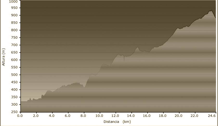
STAGE SUMMARY
Length of walk: 23,200 km
Maximum altitude: 921m
Minimum altitude: 320m
Maximum elevation: 713m
Ascent-Descent Gradient: 560m
Maximum altitude: 921m
Minimum altitude: 320m
Maximum elevation: 713m
Ascent-Descent Gradient: 560m
DATASHEET
*To save the original file to press the right bottom on the link and choose the option “Save the link as…”
GENERAL DESCRIPTION
The route from Artés to l’Estany (literally “the lake”) runs through the pine trees and pastures of Bages. It is a long trek, with a constant but gentle uphill slope through majestic land. This is the real heart of Catalonia, a forgotten land, seeped in the culture of the local, deep-rooted traditions. During the mushroom season this is a trek on which you are sure to find them.
STAGES
- STAGE 2
VIC (OSONA) – ST JOAN DE LES ABADESSES (RIPOLLÈS)- From Vic to Folgueroles
- From Folgueroles to Casserres
- From Casserres to Vilanova de Sau
- From Vilanova de Sau to Tavertet
- From Tavertet to Esquirol (connection to the alternative route)
- From Esquirol to Sant Pere de Torelló
- From Sant Pere de Torelló to Santa Maria de Besora
- From Santa Maria de Besora to La Farga de Bebié
- From la Farga de Bebié to Ripoll
- From Ripoll a Sant Joan

