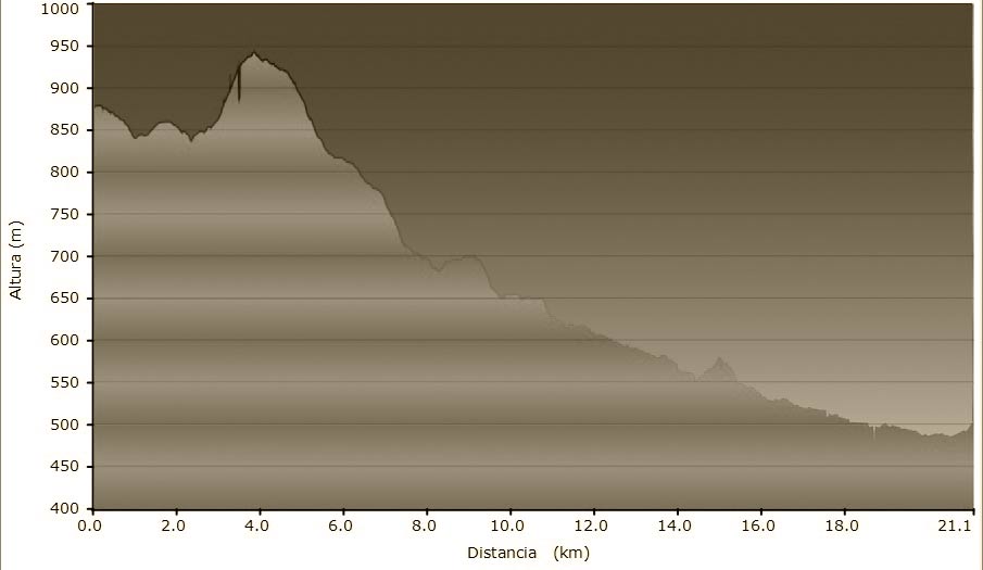
STAGE SUMMARY
Length of walk: 20,440 km
Maximum altitude: 894m
Minimum altitude: 485m
Maximum elevation: 105m
Ascent-Descent Gradient: -392m
Maximum altitude: 894m
Minimum altitude: 485m
Maximum elevation: 105m
Ascent-Descent Gradient: -392m
DATASHEET
*To save the original file to press the right bottom on the link and choose the option “Save the link as…”
GENERAL DESCRIPTION
The stage from l’Estany to Vic is a natural progression between too clearly distinct landscapes, between two counties tied together because of their closeness. The path runs through attractive scenery of the Moianès county, full of pines. The marga sediment appears and there are oaks and Holm oaks in a flat landscape of meadows and green crops, with farmhouses (masies) dotted around.
The path of the Bishop and Abbot Oliba changes scenery from here onwards, from the dry heart of Catalonia to the green pastures of Osona and Ripollès.
STAGES
- STAGE 2
VIC (OSONA) – ST JOAN DE LES ABADESSES (RIPOLLÈS)- From Vic to Folgueroles
- From Folgueroles to Casserres
- From Casserres to Vilanova de Sau
- From Vilanova de Sau to Tavertet
- From Tavertet to Esquirol (connection to the alternative route)
- From Esquirol to Sant Pere de Torelló
- From Sant Pere de Torelló to Santa Maria de Besora
- From Santa Maria de Besora to La Farga de Bebié
- From la Farga de Bebié to Ripoll
- From Ripoll a Sant Joan

