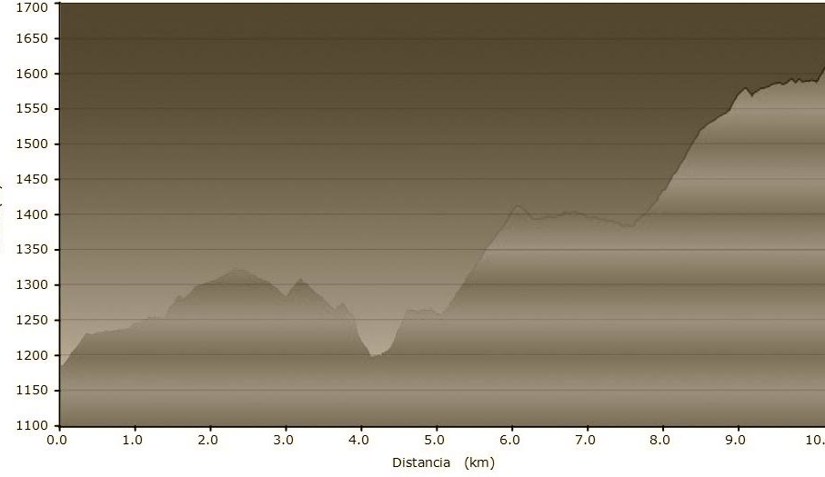
STAGE SUMMARY
Length of walk: 10,050 km
Maximum altitude: 1.622m
Minimum altitude: 1.182m
Maximum elevation: 761m
Ascent-Descent Gradient: 440m
DATASHEET
*To save the original file to press the right bottom on the link and choose the option “Save the link as…”
GENERAL DESCRIPTION
The path from Molló to the French border is a walk through the Pyrenees, like the shepherds or those walkers who in the times of the civil war dreamt of liberty in exile. Surrounded by common grazing land used for centuries to feed the cattle and sheep of the villages in the valley, the old paths offer marvelous views and finally lead us to the end of the route so well trodden in the times of the Bishop and Abbot Oliba.
STAGES
- STAGE 2
VIC (OSONA) – ST JOAN DE LES ABADESSES (RIPOLLÈS)- From Vic to Folgueroles
- From Folgueroles to Casserres
- From Casserres to Vilanova de Sau
- From Vilanova de Sau to Tavertet
- From Tavertet to Esquirol (connection to the alternative route)
- From Esquirol to Sant Pere de Torelló
- From Sant Pere de Torelló to Santa Maria de Besora
- From Santa Maria de Besora to La Farga de Bebié
- From la Farga de Bebié to Ripoll
- From Ripoll a Sant Joan de les Abadesses

