STAGE SUMMARY
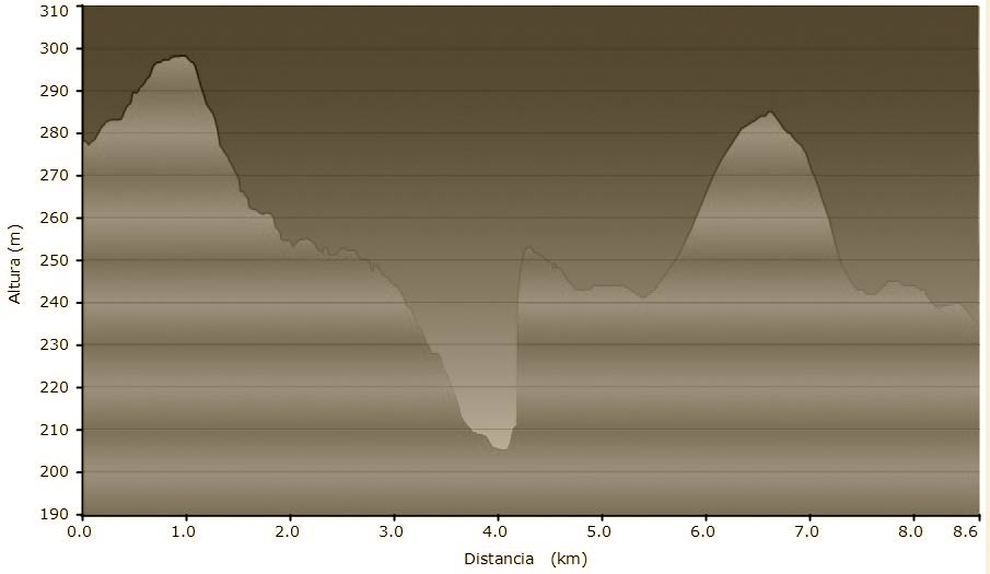
Length of walk: 11,670 km
Maximum altitude: 301m
Minimum altitude: 214m
Maximum elevation: 114m
Ascent-Descent Gradient: -8m
DATASHEET
GENERAL DESCRIPTION
The path from Manresa to Navarcles is easy going and quite flat; it is principally following the course of the rivers and canals that irrigate this territory, such as the Llobregat river. In the two cases, actually entering into Manresa, or coming straight from the route from Montserrat (we have to point out that the path going into and out of Manresa is signposted but it is not classified as a GR), you will discover the beauty and austerity of the most important Romanic building in Bages, the monastery of Sant Benet, which is just as you are coming into Navarcles.

